
Pakistan-India clash: UN resolution declares Kashmir disputed territory
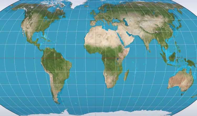
The United Nations General Assembly’s approval of a new world map projection has triggered a fresh diplomatic exchange between India and Pakistan over the status of Occupied Kashmir.
The resolution, adopted on September 4, promotes equal-area map projections, while the UN map depicts the Line of Control in Kashmir with a dotted line and notes that the territory’s final status remains unresolved.
The UN General Assembly adopted the ‘Correct the Map: Rebalancing Global Cartographic Representation and Promoting Equitable Representation of the World’s Regions, Particularly Africa’ resolution with 164 countries voting in favour.
The United States was the only country to vote against it, while Estonia, Georgia, Lithuania, Moldova, Serbia and Ukraine abstained. The initiative seeks to encourage the use of equal-area projections that more accurately represent the relative size of continents and regions, particularly Africa.
The resolution promotes alternatives to the traditional Mercator projection, which significantly distorts the apparent size of landmasses, particularly those farther from the Equator.
The move does not legally ban the Mercator map or require countries to replace existing maps. Instead, it encourages governments, educational institutions, international organisations and technology companies to consider equal-area projections where accurate comparisons of landmass size are important.
Kashmir depiction triggers controversy
The controversy emerged because the UN world map associated with the new cartographic approach depicts Jammu and Kashmir differently from India’s official maps.
The Line of Control between India and Pakistan is shown with a dotted line, accompanied by an explanation that it approximately represents the LoC agreed upon by the two countries and that the final status of Jammu and Kashmir has not been agreed upon.
The depiction has renewed attention on Kashmir’s unresolved status at the international level and triggered competing interpretations from New Delhi and Islamabad.
Pakistan has described the UN map as reflecting the disputed nature of Jammu and Kashmir, while India has rejected any suggestion that its vote amounted to accepting a particular political boundary or territorial depiction.
India says vote was about map projection
India voted in favour of the UN resolution but subsequently clarified that its support was based on the principle of equal-area cartographic representation.
Indian Ministry of External Affairs spokesperson Randhir Jaiswal said the resolution did not endorse any particular map, projection or depiction of national boundaries. He stressed that India’s sovereign territory, including Jammu and Kashmir and Ladakh, must be shown according to India’s official map.
New Delhi also said any depiction it considers inaccurate or misleading would be unacceptable, reiterating that its position on sovereignty and territorial integrity is “clear, consistent and non-negotiable.”
India’s explanation has therefore drawn a distinction between supporting the broader geographical principle behind equal-area maps and endorsing a particular map’s treatment of politically disputed borders.
Pakistan rejects India’s explanation
Pakistan’s Foreign Office rejected India’s clarification, calling New Delhi’s assertions regarding Jammu and Kashmir baseless and contrary to what Islamabad described as internationally recognised facts.
Foreign Office spokesperson Sajjad Haider Khan said India’s unilateral claims of sovereignty cannot change what Pakistan describes as the internationally recognised disputed status of Jammu and Kashmir.
Pakistan maintained that official UN maps depicting Jammu and Kashmir as a disputed territory remain an important cartographic representation of its current legal status.
🔊PR No.2️⃣3️⃣8️⃣/2️⃣0️⃣2️⃣6️⃣
— Ministry of Foreign Affairs – Pakistan (@ForeignOfficePk) September 7, 2026
Statement by the Spokesperson
🔗⬇️ pic.twitter.com/YV7kDWpZx6